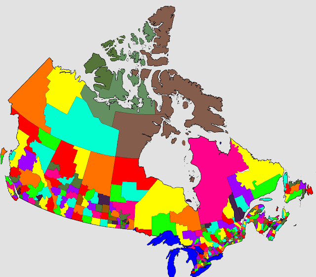
This election season has me depressed; watching everyone partake in an event that "unites" the country from coast to coast. So to cheer myself up, I made this map. No, it's not some hypothetical new riding map with more than just the 3 major parties sharing in the spoils of parliament. The above is a coloured-in version of Canada's census divisions. Census divisions don't always follow local government boundaries, especially in Alberta, so this map is more of a reflection of people than government.
Ha! "more of a reflection of people than government!" It's a government-created map. Fuck nation-states but the smaller the better. It's certainly better than this:
Or even this one:
Actually, that one looks pretty cool. But not as cool as colouring your own continent!
You may say I'm dreamer.... But I've really just been binge reading Hoppe.


No comments:
Post a Comment